
-

CARY, John
A Plan Of The Harbour Of Brest / A Plan Of The Bay & Roads Of Cadiz - 1781
Maps - Copper Engraving
17.5 x 10.5 / 17.5 x 12 cms
£21.00
-

CARY, John
Map: Sussex - 1821
Maps - Copper Engraving
10 x 15.5 cms
£105.00
-
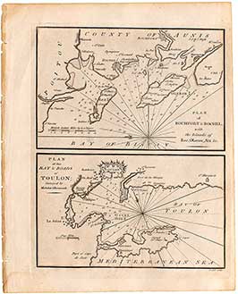
CARY, John
Plan Of Rochfort & Rochel / Plan Of The Bay & Roads Of Toulon - 1781
Maps - Copper Engraving
17.5 x 11.5 / 17.5 x 10.5 cms
£22.00
-
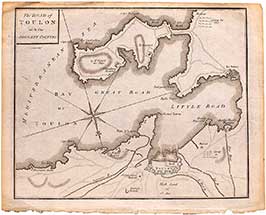
CARY, John
The Road Of Toulon With The Adjacent Country - 1781
Maps - Copper Engraving
23.5 x 19.5 cms
£22.00
call us now
:
+44 (0) 1730 812 177
Refine your search
NOTICE: We are temporarily closed to visitors (until approx February 2026).
Please call us in the meantime on 01730 812 177.
